
Showing 11 - 20 of 27 results
University of New Brunswick
Civilian Uncrewed Aerial Vehicle (UAV) for remote sensing, surveillance, and aerial imagery.
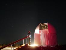
Western University (The University of Western Ontario)
Astronomical facility with optical 50 cm telescopes for rapid wide-field imaging
HEC Montréal
Management of access to databases and specialized software.

HEC Montréal
Ultra-high performance infrastructure required for rapid computations with large databases.
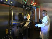
St. Joseph's Health Care London
Develops innovative emerging and new biomedical diagnostic imaging capabilities
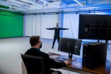
The Northern Alberta Institute of Technology (NAIT)
Captures high fidelity performances involving multiple actors, props and finger tracking; and exports animation data to media, entertainment, and health industries in various formats.
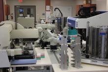
Trent University
Automated DNA extractions, microsatellite DNA profiling, forensic DNA analysis of fish and wildlife, food traceability
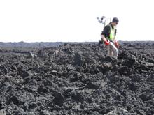
Western University (The University of Western Ontario)
Geologic interpretations of remote sensing data through ground truth data collection.
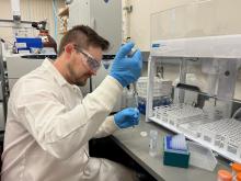
University of Northern British Columbia
Provides research and analytical testing services for material and environmental samples to the UNBC and Northern BC communities and beyond.
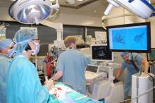
Western University (The University of Western Ontario)
Image-guided intervention research, enabling minimally-invasive surgery.